AquaTool
Software
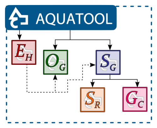
AQUATOOL+ user interface is the main component of AQUATOOL to design specific Decision Support Systems of basins or water resources systems. This application is an assistant to develop work diagrams, and data and results management.

From this interface various analysis modules, which support water resources systems planning and management, are controlled. These modules are:


This application can be downloaded and installed freely without license. The unlicensed installation allows editing and viewing results for diagrams of any size. It also allows the use of calculation modules for schemes of limited size.
AQUATOOL is a product under continuous development. Thus, versions are frequently updated without keeping copies of previous versions, except in special cases. Users can get here the latest version of the program.
Information on the different modules included in AQUATOOL
The SIMGES module is a general simulation model for river basin or complex water resources systems management where there are control or storage elements both superficial and subterranean, and elements for collection, transport, use and/or consumption, and artificial recharge of water. The model admits any configuration between some limits imposed by hardware capacities. Therefore, it can be used in any hydraulic resources scheme. The simulation is done at a monthly scale and can reproduce the water flow through the system at any spatial scale the user prefers. In the superficial subsystems the flow is calculated by continuity. The aquifers and the relations between river and aquifer are simulated with simple unicellular or multicell models or using the eigenvalues method for distributed groundwater models which consider the hydrodynamic properties of the studied aquifer. The SIMGES model also considers the return flows to the surface system and the infiltration to the groundwater. It also takes into account the evaporation and infiltration loses from reservoirs and the relationship between surface water and groundwater. The water resources management is simulated using operation rules which try to maintain a similar filling level in reservoirs from a reservoir zone curves. These curves are the operating rules themselves and are usually given by the model user. It is allowed the definition of environmental flows as well as different water use priorities. The simulation and management of the surface system are done at the same time using a network flows optimization algorithm. This algorithm determines the flows through the system trying to satisfy the multiple objectives of deficit minimization, and maximum adaptation to the reservoir objective volume curves and the hydroelectric production objectives. Moreover, this optimization is improved with an iterative process of solution of the network, what allows improving the quality of the simulation of non-linear processes such as infiltrations, evaporations and surface and groundwater relationship.
The GESCAL module was developed to evaluate the water quality at a basin level. For this it includes the calculation of all the processes or water quality modification both in rivers and reservoirs. These calculations are done at every element of the river basin scheme defined with SIMGES connecting them according to the calculated flows. Applying it to different decision alternatives in the river basin management it is possible to evaluate the consequences for the water quality in the whole basin.
The OPTIGES module solves the problem of monthly water assignment in a river basin to the different demands and storage reservoirs. To do this it solves an optimization problem for a period of one or more years. In this way, it calculates the optimal assignment of water for each period needing very few data, almost only the physical description of the basin (links, reservoirs and demands). This is a great advantage for its use in systems where little information is available or when we want to obtain general yearly conclusions. On the contrary, the monthly simulated management is not directly comparable to reality because in real systems it is impossible to know beforehand what will be the available water resources. Because of this, it requires from the user an additional effort on results interpretation to translate them to useful conclusions for management. An efficient way to validate this interpretation is to use it and improve it with the use of the SIMGES module.
The SIMRISK module was designed for its use in river basin management in the medium-term to evaluate the management risks. It runs a simulation of the management of the system for an initial condition of levels in reservoirs and aquifers, and uses as data multiple future hydrological inflows scenarios of one or more years. Probability calculations are done for each month of the simulated period from the results of all the scenarios. These can be used as probable estimation of the final situation of the system at the end of the present campaign, or after two or more hydrological years. This module was designed to be used in models calibrated with SIMGES, so each simulation is made in the same way than in SIMGES. Data edition is made from the same interface than SIMGES.
EVALHID is a module for the development of rainfall-runoff models in complex basin and which evaluates the amount of water resources produced. The module consists of several types of models that can be chosen depending on the available data, the complexity of the basin and the user’s experience in the development and calibration of hydrological models. All available models are aggregate with semidistributed application at subbasin scale.
